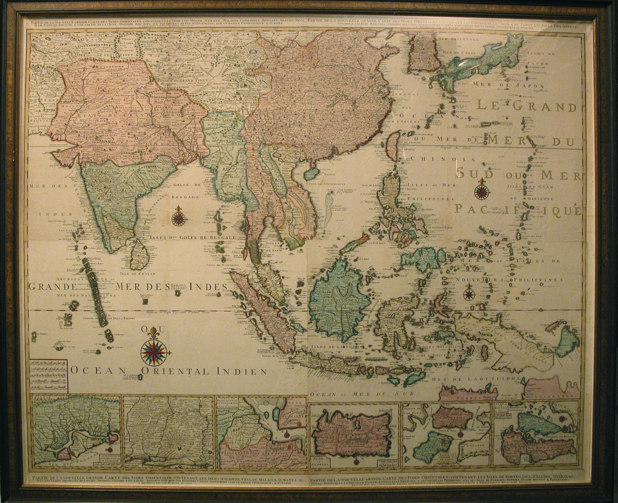
Wallmap Carte Des Indes - Far East by J.B. Elwe - Anno 1792
Make an inquiry
Original antique copperengravings with the map of South-East Asia. All four the maps beginning with :
Parte de la nouvelle grande Carte des Indes Orientalis &:
1.Contenant les Terres du Mogul, Surat, Malabar, Cormandel, Bengale, Aracan, Pegu, Siam, Camboje, Tonquin, & une partie de la Chine.
2.Contenant les Empire de la Chine et du Japon, les Isles Philippines, Couchin et les Isles Marianes.
3. Contenant les Isles Maldives, Ceylan, Malacca, Sumatra &c avec les Terres adjacentes de Couchin, Negombo & Sourabaia.
4. Contenant les Isles de Borneo, Java, Celebes, Mindanao, Gilolo, Molucques, La Nouvelle Guinee, La Nouvelle Bretagne,
et les Nouvelles Philippines : avec les Isles Sumbawa, Serbira, solor, Bouton & Pangesane.
And all the four maps ending with :
Dressee avec soin, sur plusieurs Cartes manuscrites, par une habile Conoisseur; & Publiee a Amsterdam par Ian B. Elwe.
Copperengraving, 4 sheets, coloured in by hand. Format 95 x 99 cm.
From : Atlas.Published: In Amsterdam anno 1792 by J.B. Elwe.
The map was drawn by L.Webbers and engraved on copper by J. Van Munnikhuijse.
Literature :
Atlantes Neerlandici by C. Koeman, part II page 106 (EL2) Map number 30.
Framed in ebonised wooden frame:
Height: 108,5 cm. (42,7 inches.)
Width: 130,5 cm. (51,4 inches.)
- Reference
- WP.251
- Price
- Price on request
- Share