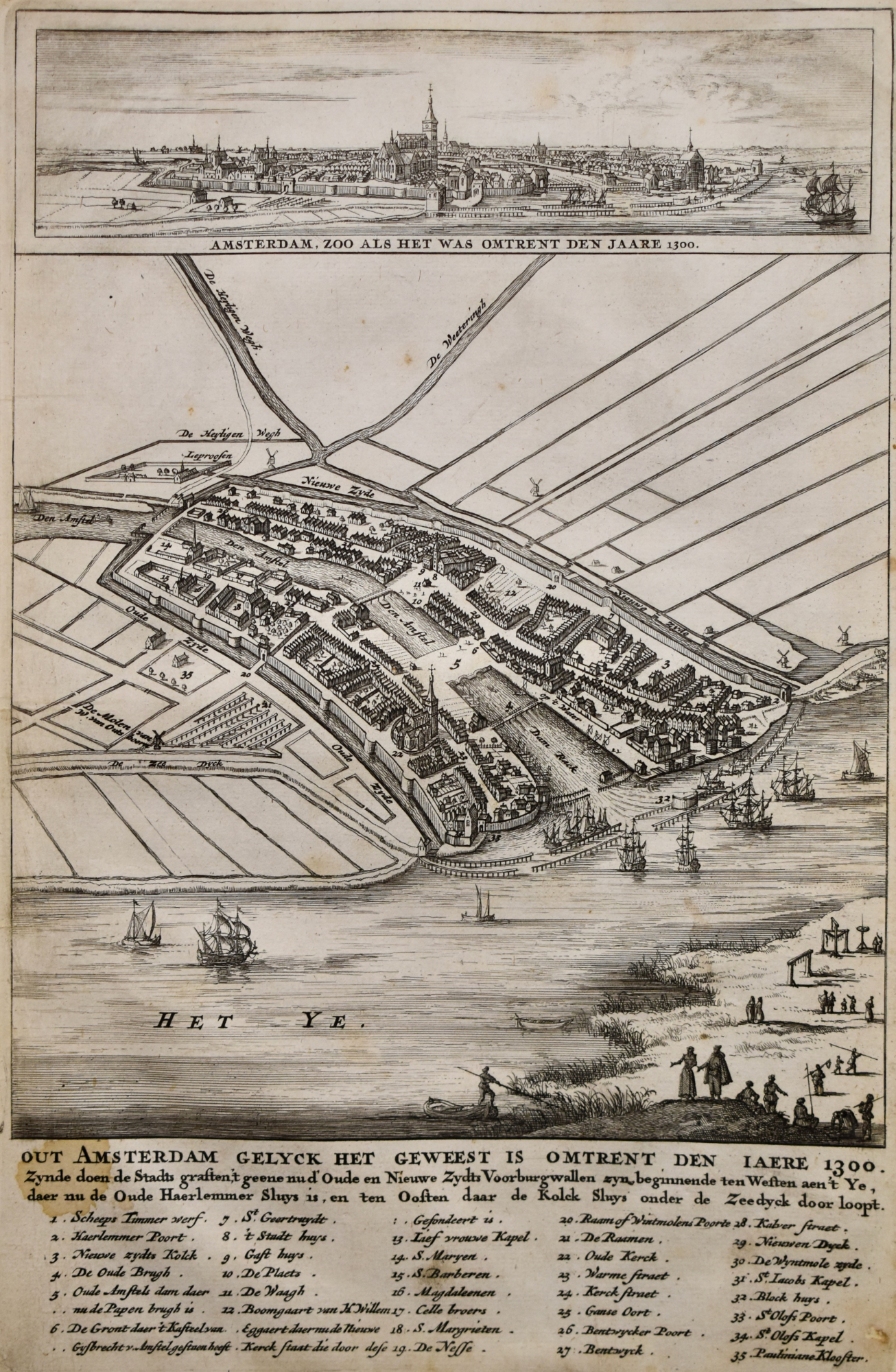
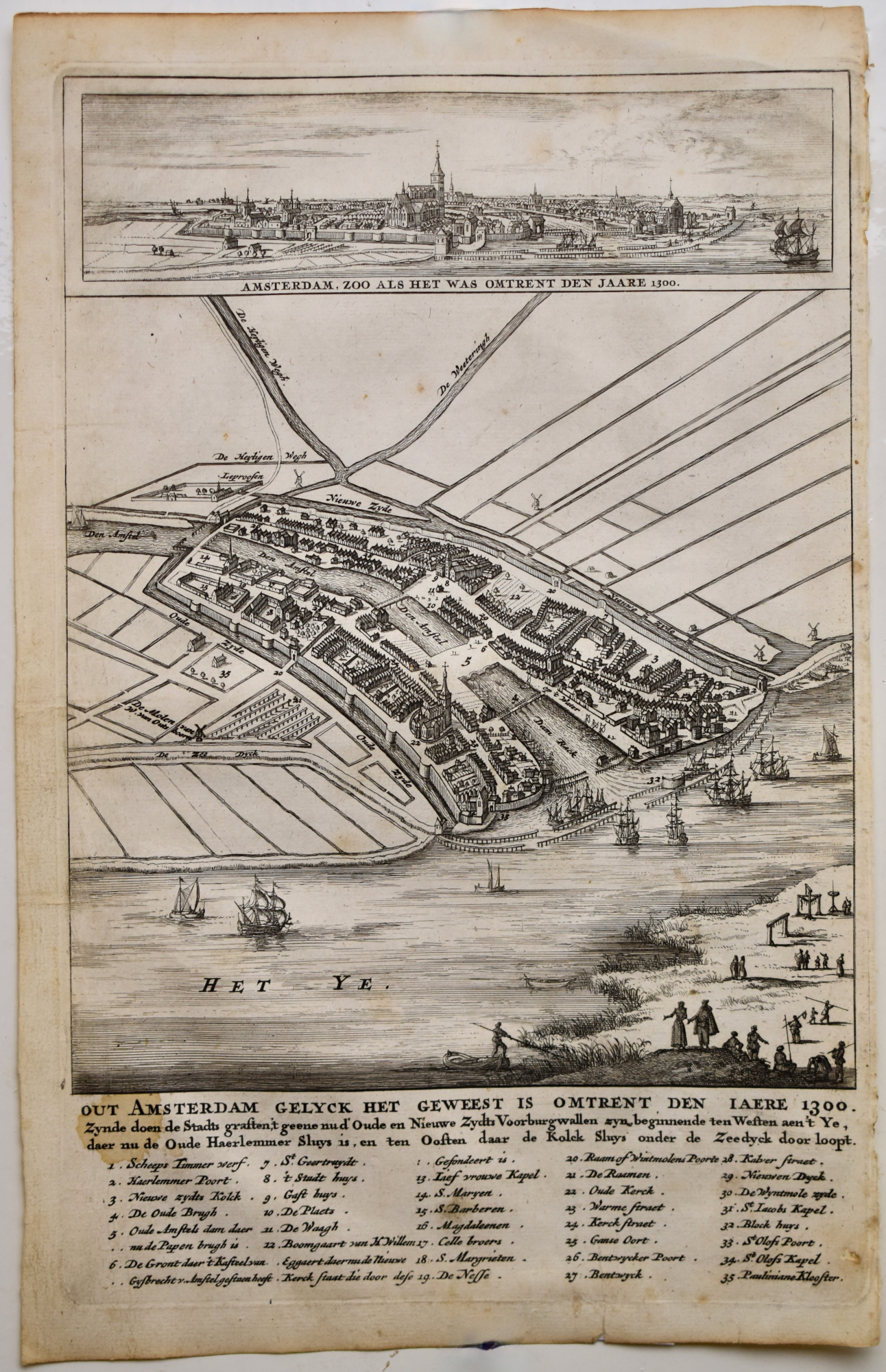
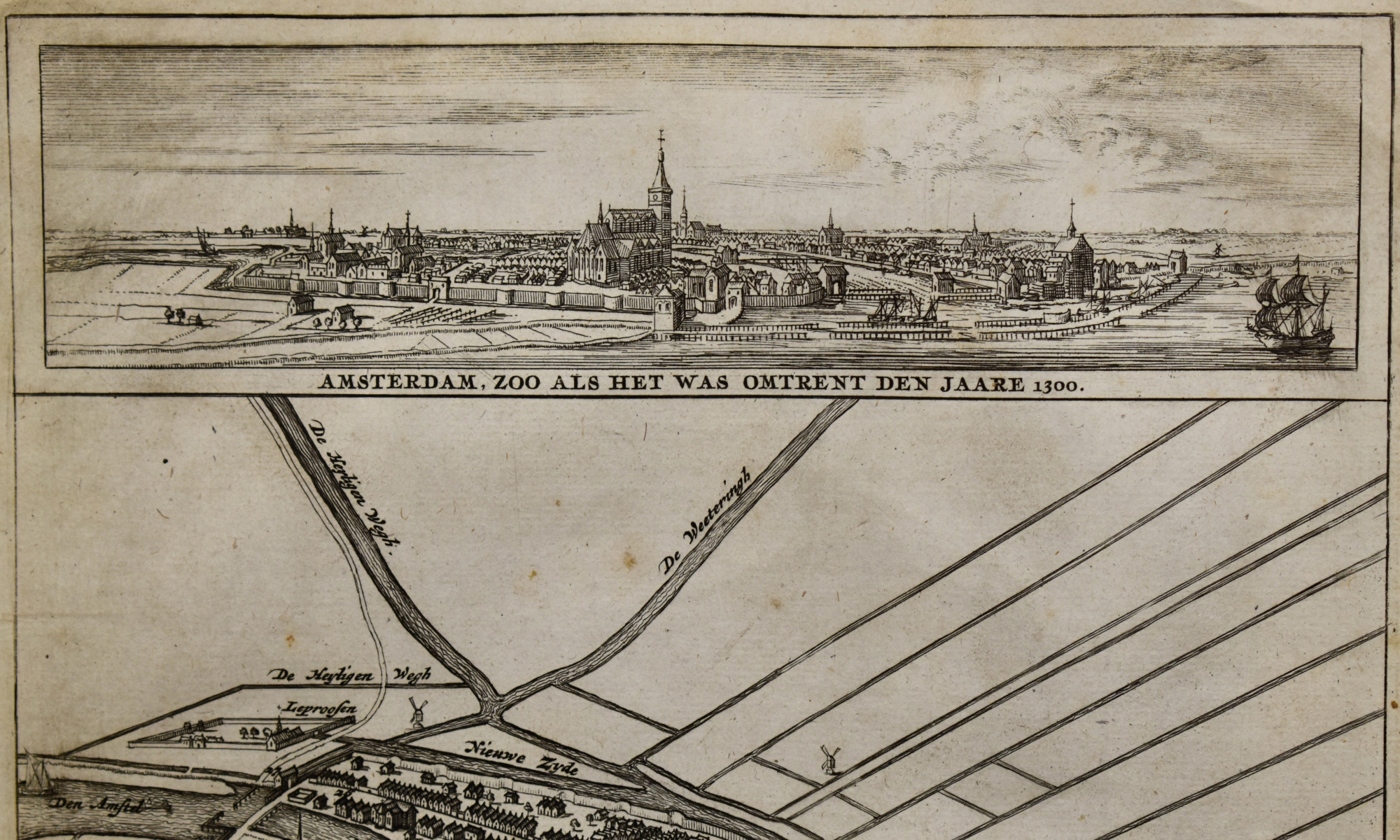
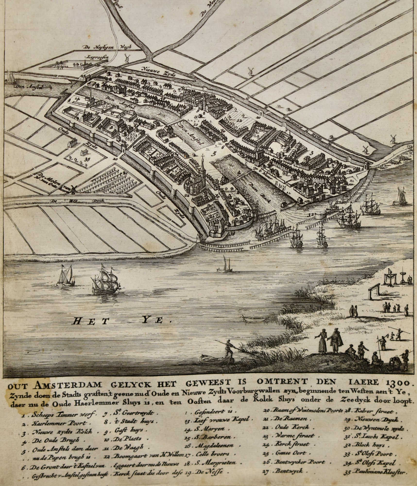
Map of Amsterdam in 1300. Casparus Commelin 1726. Antique Copper Engraving
Make an inquiry
Original antique copper engraving with the map of Amsterdam in 1300. Uncoloured.
OUT AMSTERDAM, GELYK HET GEWEEST IS OMTRENT DEN JAERE 1300. Zynde doen de Stads graften,’t geene nu d’Oude en Nieuwe Zyds Voorburgwallen zijn, beginnende ten Westen aen ’t Ye, daer nu de Oude Haarlemmer Sluys is, en ten Oosten daar de Kolck Sluys onder d Zeedijk door loopt.”
Title with Dutch text under the engraving with legenda 1 – 35. In top panorama of the city with the text:
“Amsterdam, zoo als het was omtrent den jaare 1300”
From: Beschrijvinge der Stad Amsterdam by CASPARUS COMMELIN in 1691.
Issued by Wolfgang, Waasberge etc. in Amsterdam, second issue 1726
Literature:
A.E.d’Ailly, Catalogus Amsterdamsche plattegronden Gemeentearchief Amsterdam. Number 23
Kaarten van Amsterdam 1538- 1865. Stadsarchief Amsterdam Blz .185 Cat.90
The map shows Amsterdam around 1300, seen from an idea in the 17th century, with 17th century trade ships in the medieval harbour. The city already with the city-wall between the Oude - & Nieuwe Zijds Voorburgwallen and the Spui. The Old Church already shown.
Format engraving: 29 x 18 cm. (11,4 x 7,1 inches.)
N.B. Small spot in text OUT AMS
Minor tear in paper under right
- Reference
- WP.065C
- Price
- € 150
- Share