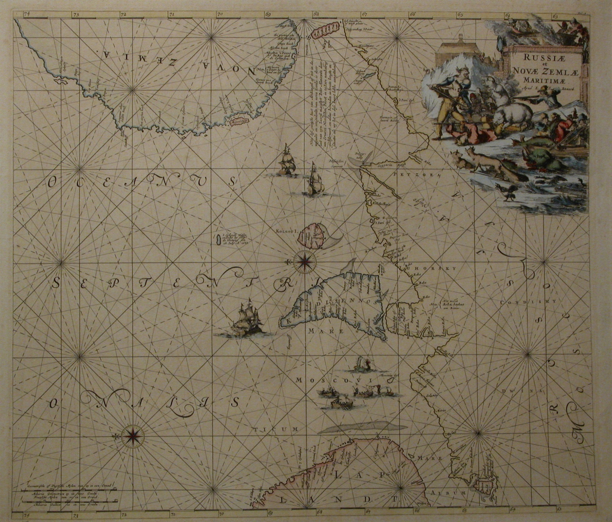
Nautical Chart of NOVA ZEMBLA. Louis Renard 1715. Antique Copper Engraving
Make an inquiry
“ RUSSIAE et NOVAE ZEMBLAE MARITIMAE - Apud L. Renard. “
Antique nautical chart with the title in colum top right surrounded with huntingscenes on arctical animals.
In the chart the text:
“ Nota dese gantsche kust van Archangel af tot in de wegaads en een gedeelte van Nova Zembla, is door last van zijn Zaarse
majestyt Peter Alexwitz door een ervaren Noordschen Piloot in 15 jare nauwkeurig geobsreveert en aldus bevonden in breete
lengte en situatie als wij het in dese kaart hebbe aangetekent.”.
Under left two scale bars with “ Geometrische of Duytsche mylen ‘ and with “ ranse mijlen."
Original antique copperengraving. Handcoloured
From Atlas de la Navigation.
Issued In Amsterdam bij Louis Renard – ANNO 1715
Literature:
Atlantes Neerlandici by Prof dr Ir C. Koeman. Part IV page 432.Ren I.
Format engraving: 49.2 x 56,5 cm. (19,4 x 22,2 inches.)
- Reference
- WP.202
- Price
- Price on request
- Share