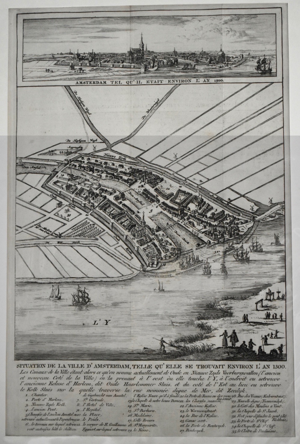
Map of Amsterdam in 1300. E. Maaskamp 1812. SOLD.Antique Copper Engraving
Original antique copper engraving with the map of Amsterdam in 1300. Uncoloured.
“Situation de la ville d’Amsterdam telle qu’il se trouvait environ l’an 1300.etc.” = OUT AMSTERDAM, GELYK HET GEWEEST IS OMTRENT DEN JAERE 1300.
Zynde doen de Stads graften,’t geene nu d’Oude en Nieuwe Zyds Vorrburgwallen zijn, beginnende ten Westen aen ’t Ye, daer nu de Oude Haarlemmer Sluys is, en ten Oosten daar de Kolck Sluys onder de Zeedijk door loopt.”
Title in French with text under the engraving with legenda 1 – 35.
In top profile of the city with the text:
“Amsterdam, Tel Qu’il etait environ l’an 1300.” = Amsterdam als het was omtrent den jaare 1300 ”.
From: Nouvelle Statistique Historique d’Amsterdam
by E. Maaskamp in 1811 on the Dam / Kalverstraat in Amsterdam.
Literature:
A.E.d’Ailly, Catalogus Amsterdamsche plattegronden Gemeentearchief Amsterdam. Number 24.
Format engraving: 29 x 18 cm. (11,4 x 7,1 inches.)
The map shows Amsterdam around 1300, seen from an idea in the 17th century, with 17th century trade ships in the medieval harbour. The city already with the city-wall between the Oude - & Nieuwe Zijds Voorburgwallen and the Spui. The Old Church already shown.
- Reference
- WP.065b
- Price
- sold
- Share