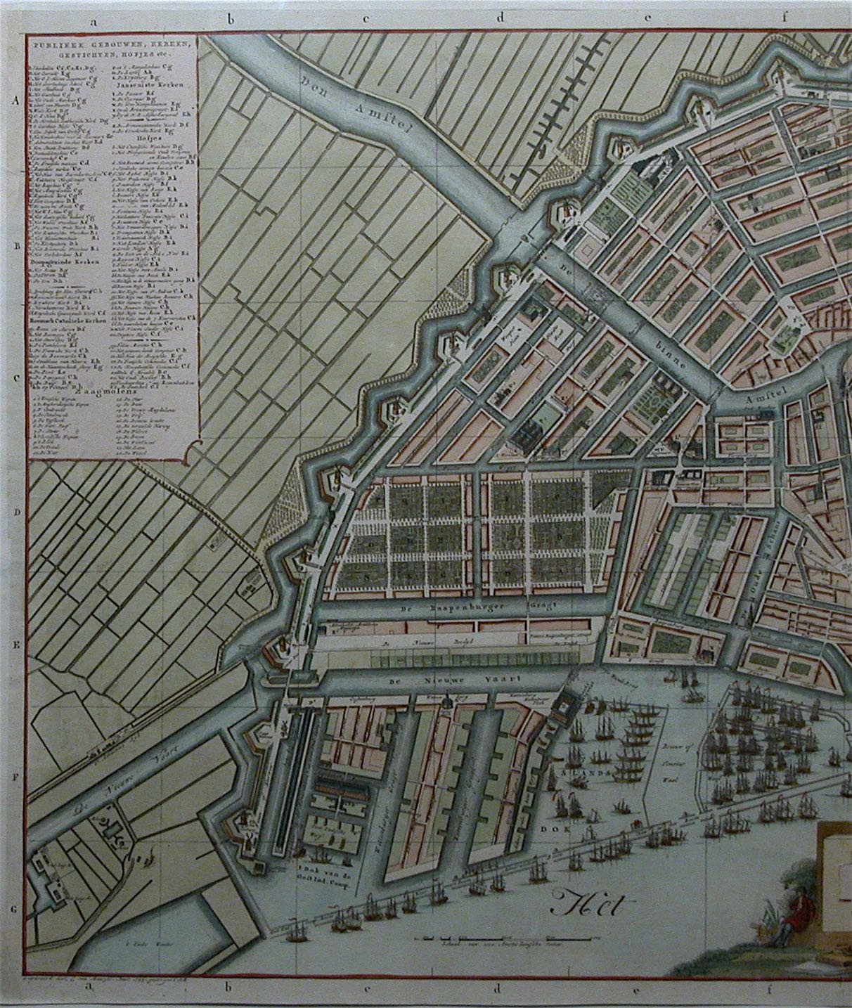

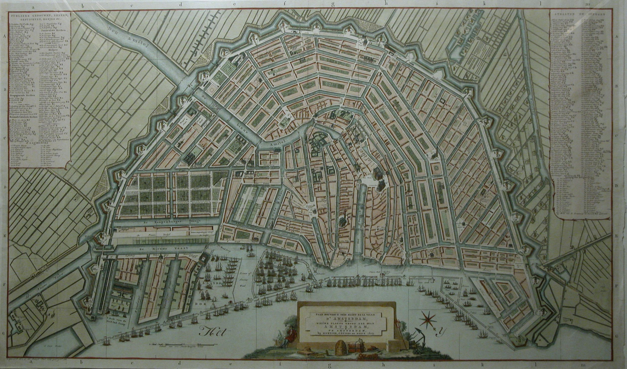


Large Map of Amsterdam in 1806 Mortier, Covens & Son 1809. Antique Copper Engraving
Make an inquiry
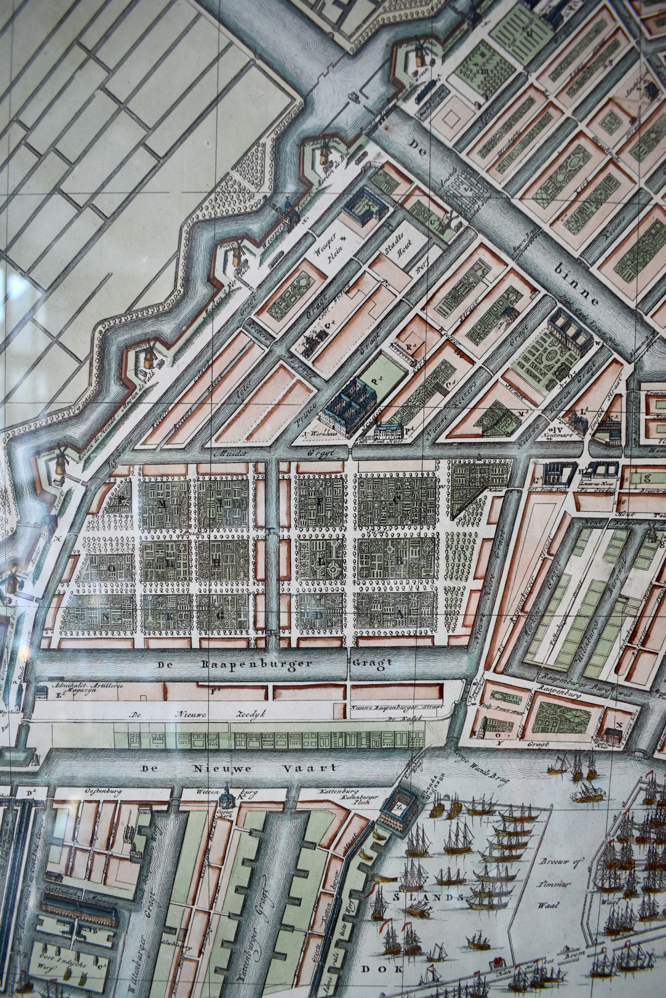
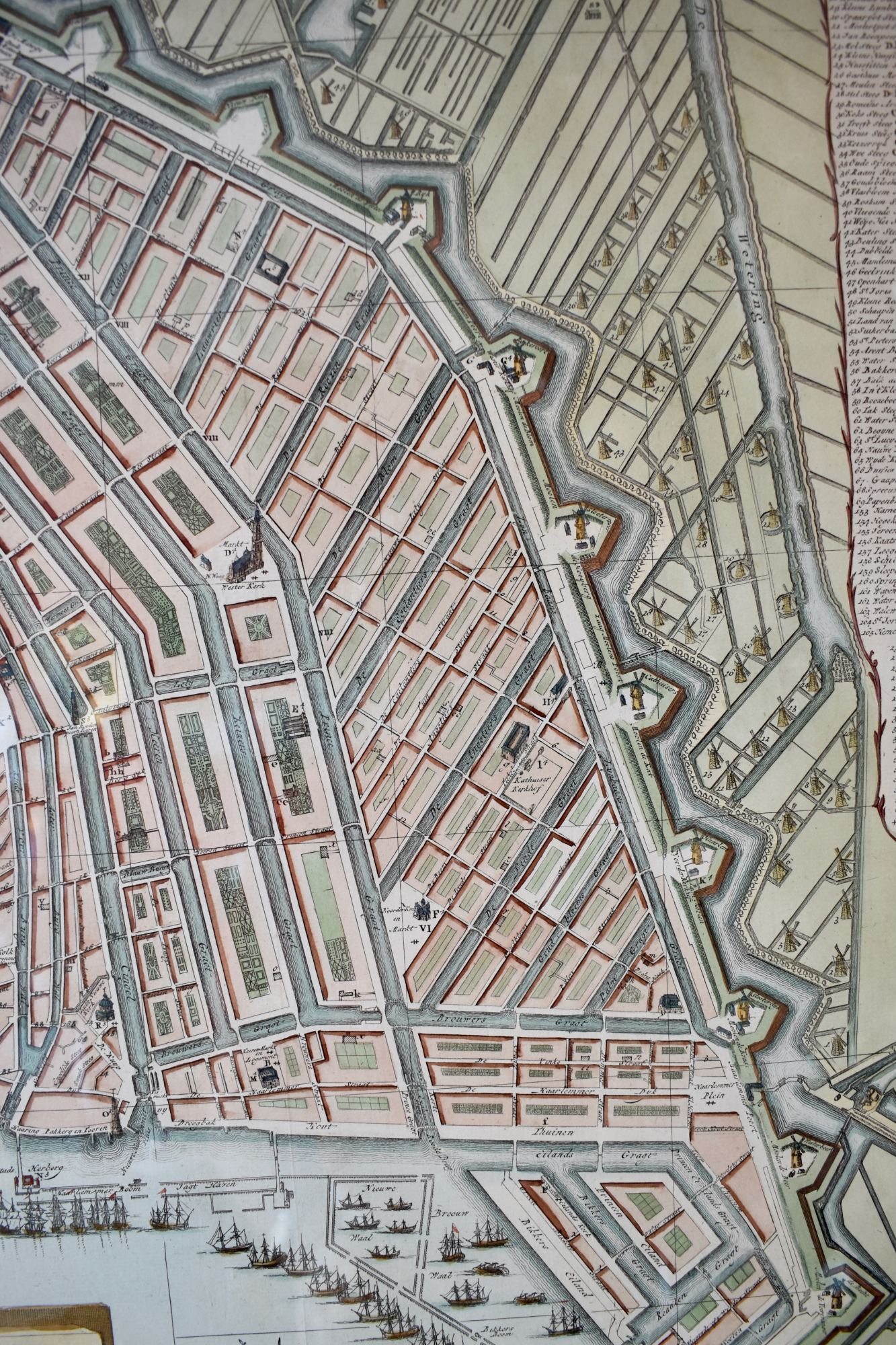
Original antique copper engraving, handcoloured.
"Plan nouveau et tres exact de la ville d ' Amsterdam , Nieuwe platte grond der stad Amsterdam. Te Amsterdam bij Mortier, Covens en Zoon 1809."
Text in French and Dutch on paper on a big stone mid under and several emblemata for trade an shipping . Further some canons. On the left in the Harbour IJ a scalebar with 2000 Amsterdam feet and on the right a compass. Top left legenda in two columns of public buildings, churches, Institutions etc. B - zz and the saw-mills 1 - 22. Top right legends in two columns with streets and alleys 1 - 152 and the rest of the saw-mills 23 -58 and + g. Under the engraving left the text:
Gegraveerd door G. Van Baarsel, Amst. 1795. Gecorrigeerd 1806. (Engraved on copper by G. van Baarsel in 1795. Altered in 1806.)
Published 1809 in Amsterdam by Mortier, Covens & Son.
Literature:
A.E. d' Ailly, Catalogus Amsterdamsche plattegronden Gemeente archief Amsterdam. Number 352.
Kaarten van Amsterdam 1538- 1865. Stadsarchief Amsterdam Blz .260 Cat.136 7e uitgave
Format engraving, 2 sheets: 55 x 94 cm. (21.6 x 37 inches.)
Framed in burr-walnut of 5 cm. with coloured acid-free passe-partout.
Height: 87 cm. (34.3 inches.)
Width: 127 cm. (50 inches.)
- Reference
- WP.180
- Price
- Price on request
- Share