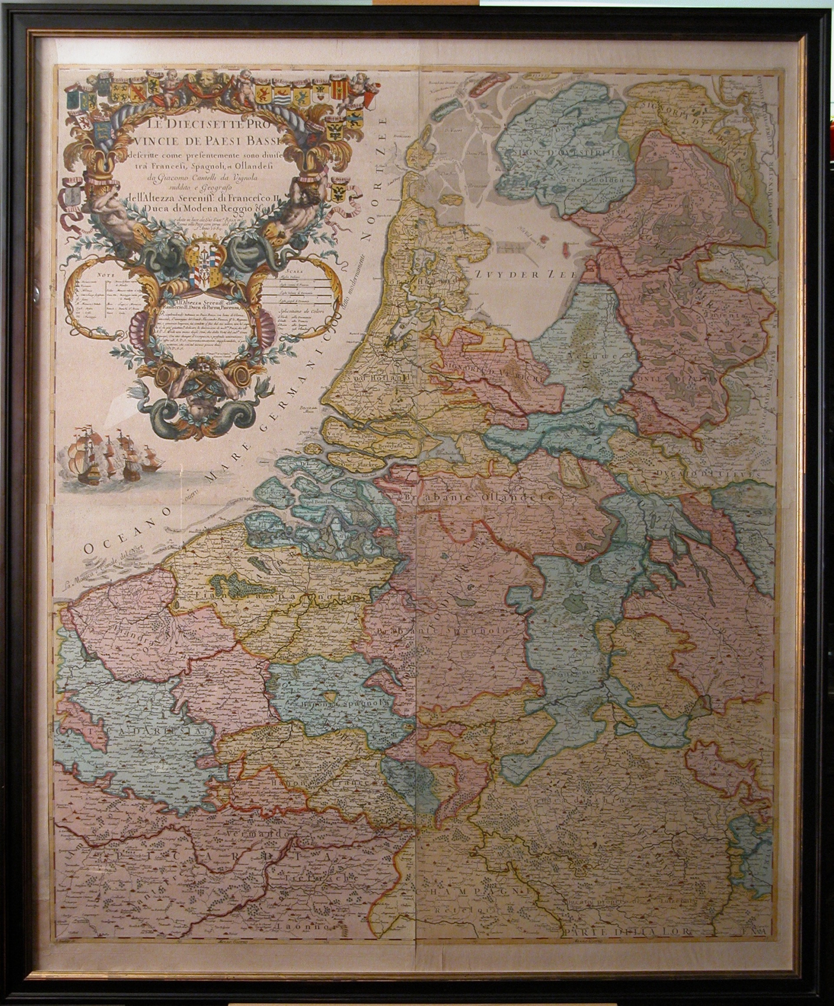
WALL-MAP THE NETHERLANDS - 1689
Make an inquiry
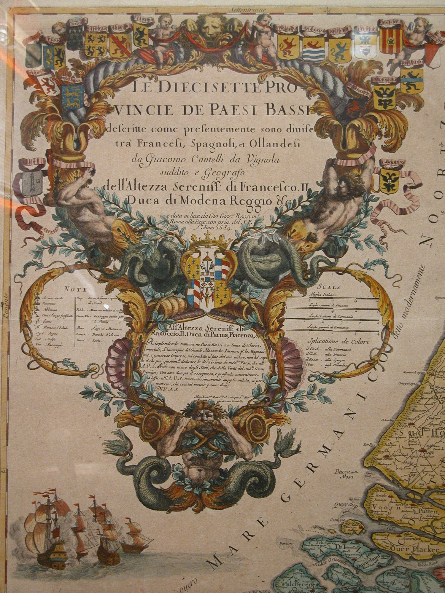
The 17 United States of the Netherlands – ANNO 1689
“ LE DIECISETTE PROVINCIE DE PAESI BASSI
Descritte come presentemente sono diuise tra Francesi, Spagnoli ,et Ollandesi. da Giacomo Cantelli da Vignola sudddito e Geografo
Dell’Altezza Sereniss: di Francesco II Duca di Modena Reggio & Ce.
Edata in luce da Gio Giac. Rossi in Roman olla Pace ,con priu.del S.P. L’ Anno 1689.
Titel in cartouche top left.
Scale: circa 1 : 420.000
By : Gio. Giacomo de Rossi , Roma, Anno 1689
Engraved by Antonio Barbey. Copperengraving. Four sheets, handcoloured.
Format: 105 x 90 cm. ( 41.3 x 35.4 inches )
Issued by Giacomo Cantelli da Vignola
This wall-map is widely known and appriciated because of its large richly decorated cartouche of 45 cm ( 18 inches )
Tis map is dedicated to the grandfather of Ranuccio II Farnese, Duke of Parma,
His Grandfather was the famous Duke” Hertog van Parma”, who conquered the Southern Netherlands for Spain from the
Protestant Northern Netherlands during thieir independant war of 80 years against catholic Spain.
Literature:
Old Maps of the Netherlands 1548-1794, by H.A.M. van der Heijden
Shown on page 563, map 179.
In ebonised frame . 121 x 101 cm.( 47,7 x 39,8 inches.)
- Reference
- WP.037
- Price
- Share